Thank you for your patience while we retrieve your images.
Y's Vancouver Photography
Favs
2018
Older
▼
Older
▼
2017
2016
2015
2014
2013
2012
2011
2010
2009
2008
2007
2006
2005
2004
2003
Ancient History
Really Old
Trips
▼
Trips
▼
Hawaii - Oahu (2015)
Ucluelet (2014)
Whistler (2014)
Hawaii - Oahu (2013-2)
Hawaii - Oahu (2013-1)
Zion NP (2012)
Las Vegas (2012)
Hawaii - Maui (2012)
Moscow (2011)
Hawaii - Oahu (2011)
San Diego (2010)
Hawaii - Oahu (2010)
Hawaii - Oahu (2009)
Oregon, San Fran (2008)
Paris, Moscow (2008)
China (2006)
Alaska (2004)
Lucy
Hikes
Life's a Beach
Vancouver
Collections
▼
Collections
▼
Collections...
Aircrafts
Alouette River
Animals
Black & White
Birds
Bridges
Cars
Clouds & Sky
Fall Colours
Food
Fraser
HDR
Life's A Beach
Lighthouses
Lights & Shadows
Macro & Closeup
Baker
Murals
Panoramas
Pets
Photogs in Action
Photoshopped
Port Moody
Boats
Squares
Sculpture
The Moon
Vancouver
All
Contact Info
Blog
Home
»
All Photos
»
2008
»
2008.10.18 The Lions Hike
Visitors
239
Modified
3-Nov-08
Created
2-Nov-08
26
photos
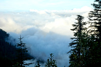
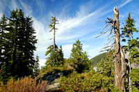
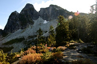
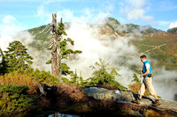
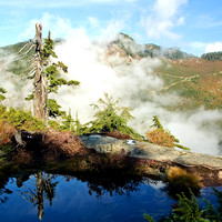
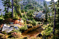
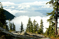
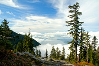
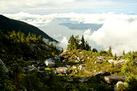
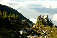
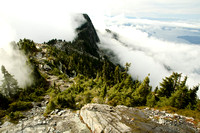
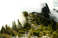
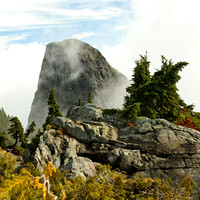
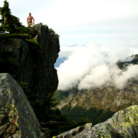
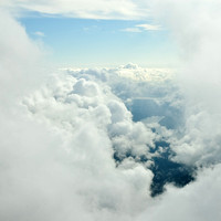
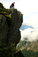
Заключительный хайк'08
The last hike'08
Это место
на карте
/ Where it is
on the map
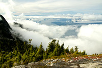
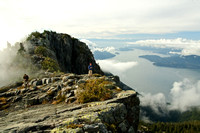
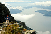
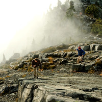
#40 Lions (Binkert Trail):
15 km roundtrip, elevation gain about 1280m, high point ~1525m, average grade 17.1%.
Driving distance from Vancouver - 40 km
(from 103 Hikes in Southwestern British Columbia by J.Bryceland)
Другие альбомы 2008-го года / Other 2008 albums
Главная страница / Y's Home page
2005 The Lions hike photos
Все походы / All hikes
Categories & Keywords
Category:
Travel and Places
Subcategory:
North America
Subcategory Detail:
Canada
Keywords:
hikes
,
howe sound
,
kamorka
,
mountains
,
outdoor
,
the lions
© Y's Vancouver Photography